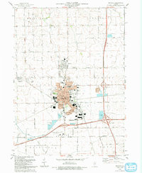
1993 Map of Rochelle
USGS Topo · Published 1993About this map
Rochelle serves as a significant regional crossroads in northern Illinois, situated at the boundary of Ogle Co and Lee Co. This early 1990s record documents the community's evolution into a modern transportation and agricultural center, anchored by the East-West Illinois Tollway and a dense network of municipal parks like Kelley Park and Atwood Park. The map captures the northern expansion of the town toward Hillcrest and the industrial activity near Flagg Center to the west. Local genealogy and civic history are well-preserved through detailed labeling of institutional landmarks, including Lawnridge Cem, St Patricks Sch, and the Rochelle Municipal Airport (Koritz Field). The landscape is defined by the winding course of the Kyte River and its tributaries, reflecting the area's rich drainage system including Brush Creek and Beach Creek.
Find a feature on this map
66 named features on this map. Tap any name to fly to it.
Don’t see what you’re looking for? This feature index may not catch every label — zoom into the map to look around manually.
Map Details
Editions of this 1993 Rochelle Map
This is the sole edition of this map. No revisions or reprints were ever made.
Other maps of this area

1917 · Kings
USGS Topo · 1:62,500

1918 · Kings
USGS Topo · 1:62,500

1918 · Kirkland
USGS Topo · 1:62,500

1934 · De Kalb
USGS Topo · 1:62,500

1937 · De Kalb
USGS Topo · 1:62,500

1952 · Rochelle
USGS Topo · 1:62,500

1954 · Rockford
USGS Topo · 1:250,000

1955 · Rockford
USGS Topo · 1:250,000

1958 · Aurora
USGS Topo · 1:250,000

1958 · Rockford
USGS Topo · 1:250,000