
1918 Map of Kirkland
USGS Topo · Published 1918About this map
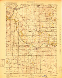
The Kishwaukee River flows through a landscape defined by an intensive network of early 20th-century railroads and rural schoolhouses. Agricultural life is anchored by towns like Kirkland and Kingston, which served as vital transit points for the Chicago Milwaukee and St Paul and other lines. The map reveals a dense settlement pattern of family-named schools and small hamlets such as Irene, Fairdale, and Esmond. Local genealogy and land use are further marked by sites like the Bloods Point Cemetery and Shattucks Grove Cemetery. This survey, produced by the U.S. Geological Survey in cooperation with the War Department, documents the region just as modern road networks were beginning to augment the established steam and electric rail corridors, including the Chicago Rockford and Interurban.
Find a feature on this map
93 named features on this map. Tap any name to fly to it.
Don’t see what you’re looking for? This feature index may not catch every label — zoom into the map to look around manually.
Map Details
Editions of this 1918 Kirkland Map
4 editions found
Other maps of this area

1917 · Kings
USGS Topo · 1:62,500

1918 · Rockford
USGS Topo · 1:62,500

1918 · Belvidere
USGS Topo · 1:62,500

1918 · Kings
USGS Topo · 1:62,500

1932 · Harvard
USGS Topo · 1:48,000

1934 · De Kalb
USGS Topo · 1:62,500

1937 · De Kalb
USGS Topo · 1:62,500

1937 · Sycamore
USGS Topo · 1:62,500

1937 · Harvard
USGS Topo · 1:62,500

1938 · Genoa
USGS Topo · 1:62,500