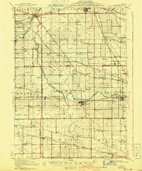
1918 Map of Kirkland
USGS Topo · Published 1941About this map
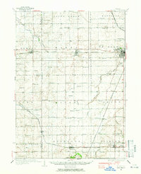
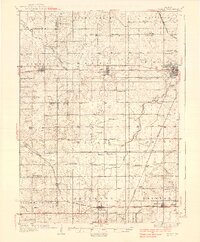
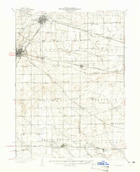
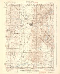
The Kishwaukee River snakes through the center of this rural landscape, anchoring a network of small agricultural settlements and one-room schoolhouses at the start of the 1940s. The village of Kirkland serves as a local hub, situated where the Chicago Milwaukee and St Paul railroad crosses the landscape. This area, spanning the borders of DeKalb, Boone, Winnebago, and Ogle Counties, preserves the precise locations of dozens of district schools such as Canada School, Vanderook School, and Witbeck School.
Find a feature on this map
88 named features on this map. Tap any name to fly to it.
Don’t see what you’re looking for? This feature index may not catch every label — zoom into the map to look around manually.
Map Details
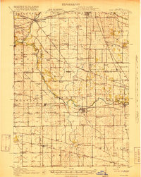
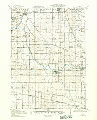
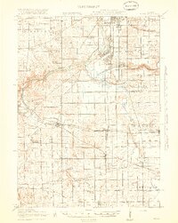
Editions of this 1918 Kirkland Map
4 editions found
Other maps of this area

1917 · Kings
USGS Topo · 1:62,500

1918 · Rockford
USGS Topo · 1:62,500

1918 · Belvidere
USGS Topo · 1:62,500
1918 · Kings
USGS Topo · 1:62,500

1918 · Kirkland
USGS Topo · 1:62,500

1932 · Harvard
USGS Topo · 1:48,000
1934 · De Kalb
USGS Topo · 1:62,500
1937 · De Kalb
USGS Topo · 1:62,500
1937 · Sycamore
USGS Topo · 1:62,500
1937 · Harvard
USGS Topo · 1:62,500
Featured Places
- Rockford, Rockford Township
- Belvidere, Belvidere Township
- Kirkland, Franklin Township
- Kingston, Kingston Township
- Monroe Center, Monroe Township