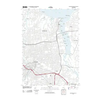
2010 Map of Rochester East
USGS Topo · Published 2010About this map
Irondequoit Bay and its complex shoreline dominate the eastern portion of this Monroe County landscape, where residential growth meets the waters of Lake Ontario. The terrain is shaped by the Genesee River valley to the west, home to sprawling institutions like the University of Rochester and Brockport State University. Notable for its many historic lakeside communities, the area includes Sea Breeze, Point Pleasant, and Glen Haven, which reflect a long history of recreation and maritime industry. Large burial grounds, including the historic Mount Hope Cemetery and Riverside Cemetery, provide significant genealogical landmarks. Transport corridors like the Frederick Douglass-Susan B. Anthony Memorial Bridge and the Irondequoit Bay Bridge facilitate modern movement across the river and bay, while natural high points like Cobbs Hill and Pinnacle Hill offer distinct topographical relief.
Find a feature on this map
74 named features on this map. Tap any name to fly to it.
Don’t see what you’re looking for? This feature index may not catch every label — zoom into the map to look around manually.
Map Details
Editions of this 2010 Rochester East Map
This is the sole edition of this map. No revisions or reprints were ever made.
Other maps of this area

1895 · Rochester
USGS Topo · 1:62,500

1895 · Ontario Beach
USGS Topo · 1:62,500

1898 · Rochester
USGS Topo · 1:62,500

1899 · Ontario Beach
USGS Topo · 1:62,500

1900 · Macedon
USGS Topo · 1:62,500

1912 · Rochester
USGS Topo · 1:62,500

1912 · Ontario Beach
USGS Topo · 1:62,500

1920 · Rochester
USGS Topo · 1:62,500

1931 · Mendon Ponds
USGS Topo · 1:24,000

1931 · Rochester West
USGS Topo · 1:24,000