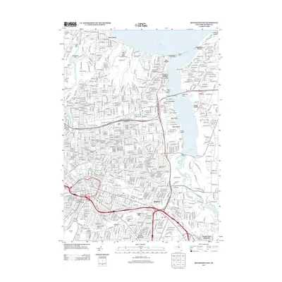
2013 Map of Rochester East
USGS Topo · Published 2013About this map
The Genesee River and the eastern expanses of Rochester dominate this modern survey, revealing a landscape defined by significant cultural landmarks and waterfront activity. The map traces the dense urban grid transitioning into the suburban communities of Brighton and Twelve Corners to the south, while the northern reaches highlight the recreational and residential shoreline of Lake Ontario at Sea Breeze and Oklahoma Beach. This area is notable for its concentration of significant burial grounds and educational institutions, including the expansive Mt Hope Cem, Holy Sepulchre Cem, and the Colgate Rochester Crozer Divinity Sch. Significant historical preservation is evident near the George Eastman House and the Landmark Society of Western New York, while modern infrastructure like the Frederick Douglass-Susan B Anthony Memorial Bridge anchors the downtown river crossing. The eastern boundary is marked by the winding waters of Irondequoit Bay, which is spanned by the Irondequoit Bay Bridge.
Find a feature on this map
56 named features on this map. Tap any name to fly to it.
Don’t see what you’re looking for? This feature index may not catch every label — zoom into the map to look around manually.
Map Details
Editions of this 2013 Rochester East Map
This is the sole edition of this map. No revisions or reprints were ever made.
Other maps of this area

1895 · Rochester
USGS Topo · 1:62,500

1895 · Ontario Beach
USGS Topo · 1:62,500

1898 · Rochester
USGS Topo · 1:62,500

1899 · Ontario Beach
USGS Topo · 1:62,500

1900 · Macedon
USGS Topo · 1:62,500

1912 · Rochester
USGS Topo · 1:62,500

1912 · Ontario Beach
USGS Topo · 1:62,500

1920 · Rochester
USGS Topo · 1:62,500

1931 · Mendon Ponds
USGS Topo · 1:24,000

1931 · Rochester West
USGS Topo · 1:24,000