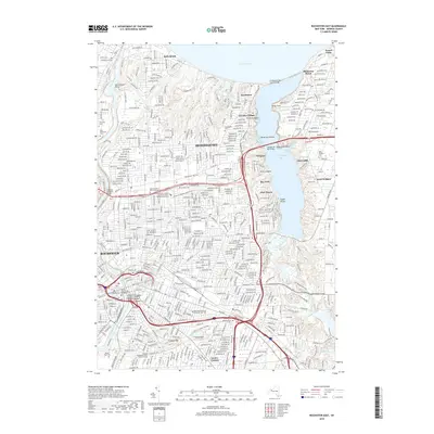
2019 Map of Rochester East
USGS Topo · Published 2019About this map
Irondequoit Bay and its complex shoreline dominate the eastern portion of this map, featuring distinct inlets like Big Massaug Cove and Helds Cove. This survey details the transition from the dense urban grid of Rochester to the residential character of Irondequoit and the lakeside communities of Sea Breeze and Rock Beach. The western edge is defined by the Genesee River, crossed by the Veterans Memorial Bridge.
Find a feature on this map
60 named features on this map. Tap any name to fly to it.
Don’t see what you’re looking for? This feature index may not catch every label — zoom into the map to look around manually.
Map Details
Editions of this 2019 Rochester East Map
This is the sole edition of this map. No revisions or reprints were ever made.
Other maps of this area

1895 · Rochester
USGS Topo · 1:62,500

1895 · Ontario Beach
USGS Topo · 1:62,500

1898 · Rochester
USGS Topo · 1:62,500

1899 · Ontario Beach
USGS Topo · 1:62,500

1900 · Macedon
USGS Topo · 1:62,500

1912 · Rochester
USGS Topo · 1:62,500

1912 · Ontario Beach
USGS Topo · 1:62,500

1920 · Rochester
USGS Topo · 1:62,500

1931 · Mendon Ponds
USGS Topo · 1:24,000

1931 · Rochester West
USGS Topo · 1:24,000