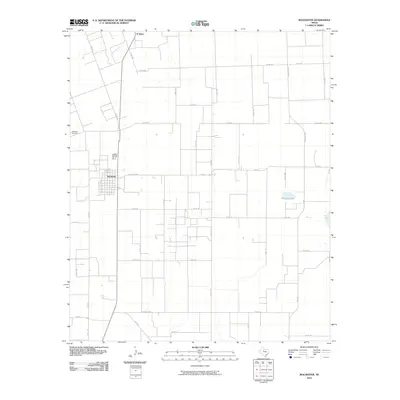
2010 Map of Rochester
USGS Topo · Published 2010About this map
Rochester serves as the primary hub of this North Texas landscape, where a grid of rural roads and state highways connects the agricultural plains of Haskell County. The town is anchored by Rochester Cemetery to the northwest and centered on Carothers Ave, with the street plan surrounded by an extensive network of county roads that reflect the area's long-established farm-to-market structure. To the north, the settlement of O' Brien sits along the northern boundary, while the drainage of China Branch cuts through the western section.
Find a feature on this map
43 named features on this map. Tap any name to fly to it.
Don’t see what you’re looking for? This feature index may not catch every label — zoom into the map to look around manually.
Map Details
Editions of this 2010 Rochester Map
This is the sole edition of this map. No revisions or reprints were ever made.
Other maps of this area

1925 · Haskell 3-b
USGS Topo · 1:48,000

1954 · Wichita Falls
USGS Topo · 1:250,000

1958 · Wichita Falls
USGS Topo · 1:250,000

1965 · Jud
USGS Topo · 1:24,000

1966 · Haskell
USGS Topo · 1:24,000
1966 · Pinkerton
USGS Topo · 1:24,000

1967 · Rochester
USGS Topo · 1:24,000

1967 · Weinert
USGS Topo · 1:24,000

1967 · Knox City NW
USGS Topo · 1:24,000

1968 · Munday West
USGS Topo · 1:24,000