
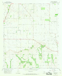
1965 Map of Jud
USGS Topo · Published 1966About this map
The confluence of the Brazos River and the Double Mountain Fork Brazos River dominates the southwestern corner of this mid-1960s landscape, marking the boundary between Stonewall and Haskell counties. The terrain is defined by the industrial footprint of the Jud Oil Field, where a dense network of oil wells, pipelines, and water injection wells intersects with rural agriculture. Near the small settlement of Jud, the land transitions from the river's winding breaks to plateaued fields dotted with springs. Local history is anchored by the Rochester Cem and Idella Cem, which serve as permanent markers of the area's early 20th-century family heritage. This survey captures a specific moment when the petroleum industry was deeply integrated into the topography of West Texas cattle and cotton country.
Find a feature on this map
12 named features on this map. Tap any name to fly to it.
Don’t see what you’re looking for? This feature index may not catch every label — zoom into the map to look around manually.
Map Details
Editions of this 1965 Jud Map
This is the sole edition of this map. No revisions or reprints were ever made.
Other maps of this area

1925 · Aspermont 4-a
USGS Topo · 1:48,000

1925 · Haskell 3-b
USGS Topo · 1:48,000

1931 · Aspermont
USGS Topo · 1:62,500

1954 · Lubbock
USGS Topo · 1:250,000

1954 · Wichita Falls
USGS Topo · 1:250,000

1958 · Wichita Falls
USGS Topo · 1:250,000

1962 · Kiowa Peak
USGS Topo · 1:24,000
1966 · Pinkerton
USGS Topo · 1:24,000

1967 · Rochester
USGS Topo · 1:24,000

1967 · Knox City NW
USGS Topo · 1:24,000