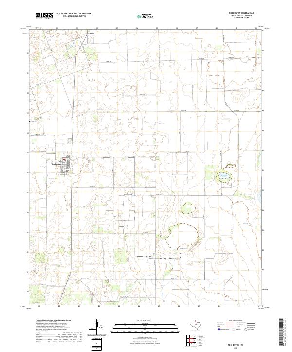
2022 Map of Rochester
USGS Topo · Published 2022About this map
The small town of Rochester serves as a focal point in this portion of Haskell County, where a grid of streets including Main St and Railroad St intersects the agricultural landscape. Just to the north, the settlement of O'Brien sits near the headwaters of China Br, illustrating the typical Texas Rolling Plains pattern of small, independent communities linked by a dense network of county roads. The landscape is characterized by intermittent water features like Mitchell Lake and an extensive grid of section-line roads such as Co Rd 168 and Co Rd 186. Genealogists and local historians can locate the Rochester Cem west of the main townsite along Cemetery Rd, while the presence of several ranch roads like Ranch Rd 2163 highlights the continued importance of cattle and cotton transport in the regional economy.
Find a feature on this map
57 named features on this map. Tap any name to fly to it.
Don’t see what you’re looking for? This feature index may not catch every label — zoom into the map to look around manually.
Map Details
Editions of this 2022 Rochester Map
This is the sole edition of this map. No revisions or reprints were ever made.
Other maps of this area

1925 · Haskell 3-b
USGS Topo · 1:48,000

1954 · Wichita Falls
USGS Topo · 1:250,000

1958 · Wichita Falls
USGS Topo · 1:250,000

1965 · Jud
USGS Topo · 1:24,000

1966 · Haskell
USGS Topo · 1:24,000
1966 · Pinkerton
USGS Topo · 1:24,000

1967 · Rochester
USGS Topo · 1:24,000

1967 · Weinert
USGS Topo · 1:24,000

1967 · Knox City NW
USGS Topo · 1:24,000

1968 · Munday West
USGS Topo · 1:24,000