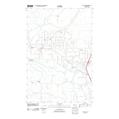
2011 Map of Rochester
USGS Topo · Published 2011About this map
Rochester serves as a central hub in this corner of Thurston County, where the topography transitions from the open stretches of Baker Prairie to the banks of the Chehalis River. The landscape is defined by its watercourses, with Scatter Creek and Black River converging toward the southwest, while Mima Creek flows down from the north. This 2011 survey reveals a well-developed grid of rural roads supporting small settlements like Grand Mound and Peterson Corner. Local history is anchored by sites such as the Grand Mound Cemetery and the R and K Skyranch Airport, which provide a sense of the community's long-standing infrastructure. The presence of Helsing Junction and Essex near the eastern boundaries highlights the transit corridors that historically linked these prairie lands to the broader region, while Michigan Hill rises to the south as a prominent local landmark.
Find a feature on this map
111 named features on this map. Tap any name to fly to it.
Don’t see what you’re looking for? This feature index may not catch every label — zoom into the map to look around manually.
Map Details
Editions of this 2011 Rochester Map
This is the sole edition of this map. No revisions or reprints were ever made.
Other maps of this area

1916 · Chehalis
USGS Topo · 1:125,000

1940 · Tenino
USGS Topo · 1:62,500

1941 · Meskill
USGS Topo · 1:62,500

1941 · Gate
USGS Topo · 1:62,500

1944 · Tenino
USGS Topo · 1:62,500

1949 · Tenino
USGS Topo · 1:62,500

1953 · Hoquiam
USGS Topo · 1:250,000

1953 · Rochester
USGS Topo · 1:62,500

1953 · Adna
USGS Topo · 1:62,500

1954 · Centralia
USGS Topo · 1:62,500