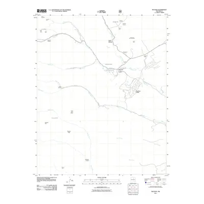
2011 Map of Rociada
USGS Topo · Published 2011About this map
Manuelitas Creek and the Sapello River converge in this high-elevation mountain valley, defining the settlement patterns of Rociada and Upper Rociada. The landscape is deeply tied to both early industry and community life, anchored by the Rociada PostOffice and the Pendaries Grist Mill. Three local burial grounds—San Jose Cemetery, San Antonio Cemetery, and Santo Niño Cemetery—provide essential touchpoints for genealogists tracing the Spanish-American heritage of San Miguel County.
Find a feature on this map
49 named features on this map. Tap any name to fly to it.
Don’t see what you’re looking for? This feature index may not catch every label — zoom into the map to look around manually.
Map Details
Editions of this 2011 Rociada Map
This is the sole edition of this map. No revisions or reprints were ever made.
Other maps of this area

1889 · Las Vegas
USGS Topo · 1:125,000

1889 · Santa Fe
USGS Topo · 1:125,000

1891 · Las Vegas
USGS Topo · 1:125,000

1893 · Las Vegas
USGS Topo · 1:125,000

1894 · Santa Fe
USGS Topo · 1:125,000

1954 · Santa Fe
USGS Topo · 1:250,000

1958 · Santa Fe
USGS Topo · 1:250,000

1961 · El Porvenir
USGS Topo · 1:24,000

1961 · Montezuma
USGS Topo · 1:24,000

1961 · Honey Boy Ranch
USGS Topo · 1:24,000