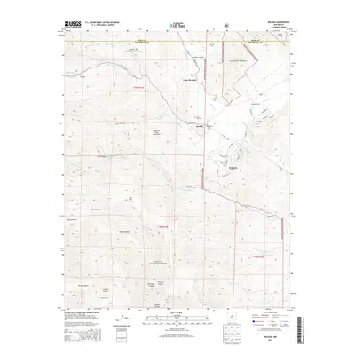
2013 Map of Rociada
USGS Topo · Published 2013About this map
Rociada and Upper Rociada sit at the eastern edge of the Sangre de Cristo Mountains, where the canyon floors open into high valleys near the Sapello River. The map illustrates a landscape shaped by agricultural history and modern recreation, featuring the Pendaries Grist Mill alongside the developing Pendaries Village. Small cemeteries like San Antonio Cem and Santo Niño Cem point to long-established family settlements, while several large properties such as Harvey Ranch and Honey Boy Ranch are noted in the southern reaches of the Santa Fe National Forest. The transition from the high peaks of Bluebell Ridge down through drainage systems like Manuelitas Cr and Daily Cr shows the vital water networks that once supported milling and ranching in this part of San Miguel County.
Find a feature on this map
57 named features on this map. Tap any name to fly to it.
Don’t see what you’re looking for? This feature index may not catch every label — zoom into the map to look around manually.
Map Details
Editions of this 2013 Rociada Map
This is the sole edition of this map. No revisions or reprints were ever made.
Other maps of this area

1889 · Las Vegas
USGS Topo · 1:125,000

1889 · Santa Fe
USGS Topo · 1:125,000

1891 · Las Vegas
USGS Topo · 1:125,000

1893 · Las Vegas
USGS Topo · 1:125,000

1894 · Santa Fe
USGS Topo · 1:125,000

1954 · Santa Fe
USGS Topo · 1:250,000

1958 · Santa Fe
USGS Topo · 1:250,000

1961 · El Porvenir
USGS Topo · 1:24,000

1961 · Montezuma
USGS Topo · 1:24,000

1961 · Honey Boy Ranch
USGS Topo · 1:24,000