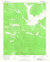
1965 Map of Rociada
USGS Topo · Published 1968About this map
Upper Rociada and the village of Rociada sit at the northern edge of the Las Vegas Grant Boundary, where the Sangre de Cristo foothills descend into the valley of the Manuelitas Creek. This mid-1960s survey captures a landscape defined by traditional Catholic anchors, including the San Jose Cem, San Antonio Cem, and Santo Niño Cem. The intersection of agriculture and emerging recreation is evident at the Pendaries Ranch, where a Golf Course and Landing Strip appear alongside older ranching infrastructure.
Find a feature on this map
39 named features on this map. Tap any name to fly to it.
Don’t see what you’re looking for? This feature index may not catch every label — zoom into the map to look around manually.
Map Details
Editions of this 1965 Rociada Map
This is the sole edition of this map. No revisions or reprints were ever made.
Other maps of this area

1889 · Las Vegas
USGS Topo · 1:125,000

1889 · Santa Fe
USGS Topo · 1:125,000

1891 · Las Vegas
USGS Topo · 1:125,000

1893 · Las Vegas
USGS Topo · 1:125,000

1894 · Santa Fe
USGS Topo · 1:125,000

1954 · Santa Fe
USGS Topo · 1:250,000

1958 · Santa Fe
USGS Topo · 1:250,000

1961 · El Porvenir
USGS Topo · 1:24,000

1961 · Montezuma
USGS Topo · 1:24,000

1961 · Honey Boy Ranch
USGS Topo · 1:24,000