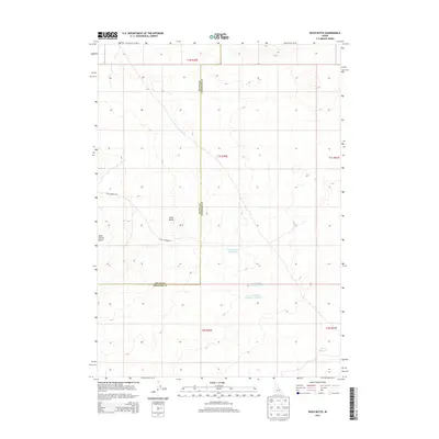
2013 Map of Rock Butte
USGS Topo · Published 2013About this map
Rock Butte and Rock Corral Butte rise from this high desert landscape on the boundary of Butte and Bingham counties. The area is defined by a system of ranching infrastructure and water management in an arid environment, characterized by small reservoirs such as Cow Pasture Reservoir Number 1, Cow Pasture Reservoir Number 2, and Moose Reservoir. This 2013 survey reveals the sparse network of rural access routes, including Cow Pasture Rd, which connect these vital water sources across the sagebrush and volcanic terrain. The map's detail provides a clear look at the Public Land Survey System divisions, marking various townships and ranges like t1s r30e and t2s r30e that dictate the organization of this remote Idaho backcountry.
Find a feature on this map
13 named features on this map. Tap any name to fly to it.
Don’t see what you’re looking for? This feature index may not catch every label — zoom into the map to look around manually.
Map Details
Editions of this 2013 Rock Butte Map
This is the sole edition of this map. No revisions or reprints were ever made.
Other maps of this area

1955 · Idaho Falls
USGS Topo · 1:250,000

1958 · Idaho Falls
USGS Topo · 1:250,000

1972 · Split Top
USGS Topo · 1:24,000

1972 · Big Southern Butte
USGS Topo · 1:24,000

1972 · Sunset Lake
USGS Topo · 1:24,000

1973 · Scoville
USGS Topo · 1:24,000

1973 · Rock Butte
USGS Topo · 1:24,000

1973 · Atomic City
USGS Topo · 1:24,000

1973 · Lava Lake Reservoir
USGS Topo · 1:24,000

1973 · Coffee Point NE
USGS Topo · 1:24,000