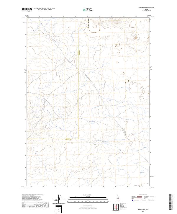
2024 Map of Rock Butte
USGS Topo · Published 2024About this map
Rock Butte serves as the central topographic focal point in this high desert landscape, which straddles the boundary between Butte County and Bingham County. This 2024 survey reveals a terrain defined by sparse water resources and cattle ranching infrastructure, characterized by several isolated reservoirs. The presence of Well Number 2 Reservoir, Cow Pasture Reservoir Number 1, and Cow Pasture Reservoir Number 2 highlights the essential role of managed water collection in this arid environment. Transportation through the area is limited to the winding Big Butte Springfield Rd, providing a look at the modern rural connectivity of this segment of the Snake River Plain. Further south, Moose Reservoir stands as another significant node in this network of vital water catchment points.
Find a feature on this map
13 named features on this map. Tap any name to fly to it.
Don’t see what you’re looking for? This feature index may not catch every label — zoom into the map to look around manually.
Map Details
Editions of this 2024 Rock Butte Map
This is the sole edition of this map. No revisions or reprints were ever made.
Other maps of this area

1955 · Idaho Falls
USGS Topo · 1:250,000

1958 · Idaho Falls
USGS Topo · 1:250,000

1972 · Split Top
USGS Topo · 1:24,000

1972 · Big Southern Butte
USGS Topo · 1:24,000

1972 · Sunset Lake
USGS Topo · 1:24,000

1973 · Scoville
USGS Topo · 1:24,000

1973 · Rock Butte
USGS Topo · 1:24,000

1973 · Atomic City
USGS Topo · 1:24,000

1973 · Lava Lake Reservoir
USGS Topo · 1:24,000

1973 · Coffee Point NE
USGS Topo · 1:24,000