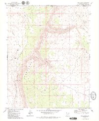
1979 Map of Rock Canyon
USGS Topo · Published 1979About this map
The Hurricane Cliffs dominate this Arizona landscape, carving a dramatic vertical line through the borderlands of Mohave County and Washington County. This late 1970s survey captures a network of historic pathways that once facilitated travel across the high desert, most notably the Temple Trail and the Honeymoon Trail. These routes follow the natural corridors provided by drainage systems like Fort Pearce Wash and Cottonwood Canyon. Water sources were critical for those traversing this arid terrain, as evidenced by remote landmarks such as Sand Spring, Coyote Spring, and Black Rock Canyon Well. The map illustrates the harsh necessity of following washes and springs in the shadow of the cliffs, reflecting the persistent geography of the Arizona Strip.
Find a feature on this map
18 named features on this map. Tap any name to fly to it.
Don’t see what you’re looking for? This feature index may not catch every label — zoom into the map to look around manually.
Map Details
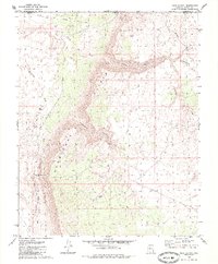
Editions of this 1979 Rock Canyon Map
2 editions found
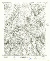
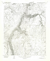
Other maps of this area

1885 · St. George
USGS Topo · 1:250,000

1886 · Mt. Trumbull
USGS Topo · 1:250,000

1891 · St. George
USGS Topo · 1:250,000

1892 · Mt. Trumbull
USGS Topo · 1:250,000

1953 · Cedar City
USGS Topo · 1:250,000

1953 · Grand Canyon
USGS Topo · 1:250,000

1954 · La Verkin 4 SW
USGS Topo · 1:24,000
1954 · Hurricane Cliffs 2 NW
USGS Topo · 1:24,000
1954 · Hurricane Cliffs 2 NE
USGS Topo · 1:24,000

1954 · La Verkin 3 SE
USGS Topo · 1:24,000