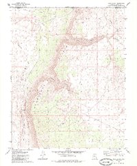
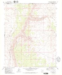
1979 Map of Rock Canyon
USGS Topo · Published 1985About this map
The Hurricane Cliffs dominate this arid landscape along the Arizona-Utah border, marking a sharp geological transition across northern Mohave County. This 1970s survey captures a network of historic migration and pack routes crossing the high desert, including the storied Honeymoon Trail and Temple Trail. These paths follow the natural breaks in the cliffs, connecting the plateau above with drainage systems below like Fort Pearce Wash and Cottonwood Canyon.
Find a feature on this map
18 named features on this map. Tap any name to fly to it.
Don’t see what you’re looking for? This feature index may not catch every label — zoom into the map to look around manually.
Map Details
Editions of this 1979 Rock Canyon Map
2 editions found
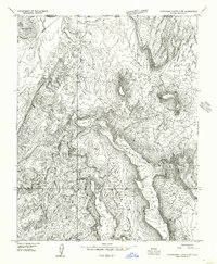
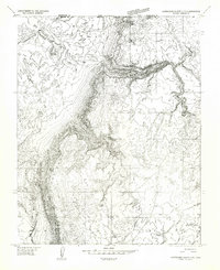
Other maps of this area

1885 · St. George
USGS Topo · 1:250,000

1886 · Mt. Trumbull
USGS Topo · 1:250,000

1891 · St. George
USGS Topo · 1:250,000

1892 · Mt. Trumbull
USGS Topo · 1:250,000

1953 · Cedar City
USGS Topo · 1:250,000

1953 · Grand Canyon
USGS Topo · 1:250,000

1954 · La Verkin 4 SW
USGS Topo · 1:24,000
1954 · Hurricane Cliffs 2 NW
USGS Topo · 1:24,000
1954 · Hurricane Cliffs 2 NE
USGS Topo · 1:24,000

1954 · La Verkin 3 SE
USGS Topo · 1:24,000