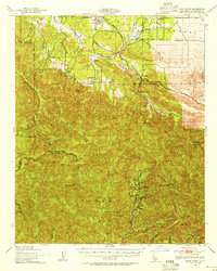
1940 Map of Rock Creek
USGS Topo · Published 1955About this map
The Andreas Rift Zone cuts a distinct geological path across this landscape, separating the high peaks of the Angeles National Forest from the high desert fringe. In the north, early settlements and landmarks like Pearblossom, Llano, and Saunders Ranch sit along the transition to the Antelope Valley. The historic Fort Tejon Road skirts the base of the Holcomb Ridge, reflecting the early transportation corridors used before modern highways. Deep in the canyon country, Valyermo and Shoemaker mark small outposts near the path of Big Rock Creek. The southern portion is dominated by the steep terrain of the San Gabriel Mountains, where the winding Angeles Crest Highway provides access to summits like Mt Islip and the recreation hub at the Crystal Lake Guard Sta.
Find a feature on this map
55 named features on this map. Tap any name to fly to it.
Don’t see what you’re looking for? This feature index may not catch every label — zoom into the map to look around manually.
Map Details
Editions of this 1940 Rock Creek Map
This is the sole edition of this map. No revisions or reprints were ever made.
Other maps of this area

1894 · Los Angeles
USGS Topo · 1:62,500

1894 · Pomona
USGS Topo · 1:62,500

1896 · Pasadena
USGS Topo · 1:62,500

1897 · Pomona
USGS Topo · 1:62,500

1897 · Cucamonga
USGS Topo · 1:62,500

1898 · Pomona
USGS Topo · 1:62,500

1900 · Pasadena
USGS Topo · 1:62,500

1900 · Tujunga
USGS Topo · 1:62,500

1900 · Los Angeles
USGS Topo · 1:62,500

1900 · Cucamonga
USGS Topo · 1:62,500