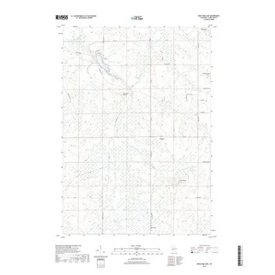
2018 Map of Rock Dam Lake
USGS Topo · Published 2018About this map
Tioga sits as the central point of interest in this portion of Clark County, where the terrain is defined by a series of distinct elevations including Bald Peak, Seven Points, and the prominent Hay Creek Mound. The landscape is heavily drained by the South Fork Eau Claire River and its numerous tributaries such as Windy Run and Scott Cr, which feed into the recreational centerpiece of Rock Dam Lake. This late 2010s survey reveals a rural infrastructure of agricultural and conservation land, highlighted by the presence of Research Farm Rd and a network of namesake thoroughfares like Abbott Ranch Rd and Koehler Ford Ln. The arrangement of these roads and the surrounding wetlands suggests a region deeply tied to both timber heritage and modern land management, with natural landmarks like Mid Mound and South Mound anchoring the high ground above the creek bottoms.
Find a feature on this map
36 named features on this map. Tap any name to fly to it.
Don’t see what you’re looking for? This feature index may not catch every label — zoom into the map to look around manually.
Map Details
Editions of this 2018 Rock Dam Lake Map
This is the sole edition of this map. No revisions or reprints were ever made.
Other maps of this area

1948 · Fairchild
USGS Topo · 1:62,500

1949 · Fairchild
USGS Topo · 1:62,500

1952 · Stanley
USGS Topo · 1:62,500

1953 · Neillsville
USGS Topo · 1:62,500

1953 · Owen
USGS Topo · 1:48,000

1953 · Eau Claire
USGS Topo · 1:250,000

1958 · Eau Claire
USGS Topo · 1:250,000

1963 · Owen
USGS Topo · 1:62,500

1964 · Eau Claire
USGS Topo · 1:250,000
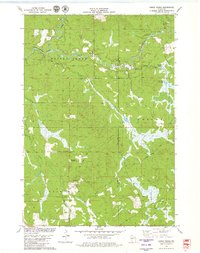
1979 · Horse Creek
USGS Topo · 1:24,000