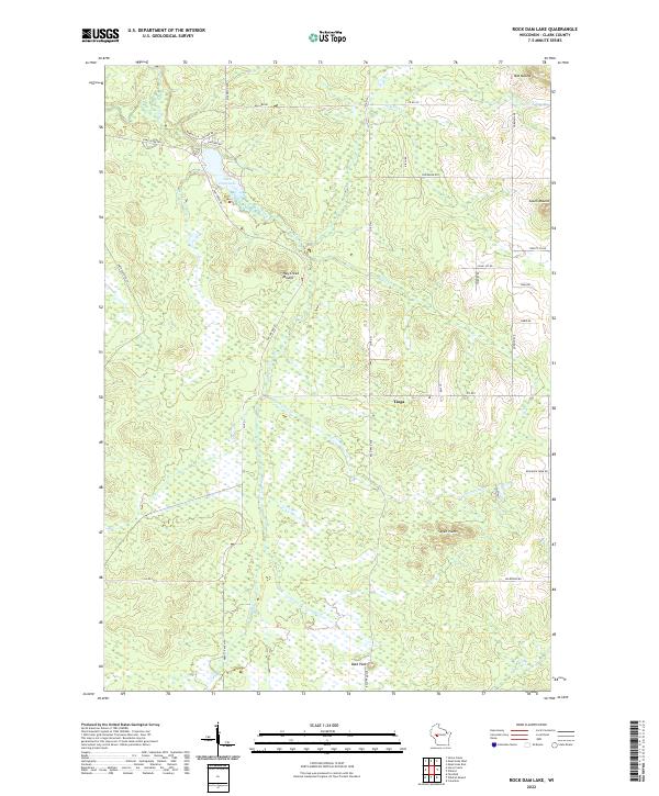
2022 Map of Rock Dam Lake
USGS Topo · Published 2022About this map
Rock Dam Lake serves as the central focal point of this Clark County landscape, surrounded by a dense network of creeks and wetlands including the Hay Creek and South Fork Eau Claire River drainages. The small settlement of Tioga is situated south of the lake, marking a point of historical continuity in this rural interior. Mapping by the U.S. Geological Survey details a terrain shaped by glacial activity, featuring prominent landforms such as Mid Mound, South Mound, and Bold Peak. The road system is dominated by county highways and rural connectors like Willard Road and Wildwood Road, which navigate a complex topography of marshland and elevated ridges, reflecting the region's enduring character as a timber and recreation area.
Find a feature on this map
2 named features on this map. Tap any name to fly to it.
Don’t see what you’re looking for? This feature index may not catch every label — zoom into the map to look around manually.
Map Details
Editions of this 2022 Rock Dam Lake Map
This is the sole edition of this map. No revisions or reprints were ever made.
Other maps of this area

1948 · Fairchild
USGS Topo · 1:62,500

1949 · Fairchild
USGS Topo · 1:62,500

1952 · Stanley
USGS Topo · 1:62,500

1953 · Neillsville
USGS Topo · 1:62,500

1953 · Owen
USGS Topo · 1:48,000

1953 · Eau Claire
USGS Topo · 1:250,000

1958 · Eau Claire
USGS Topo · 1:250,000

1963 · Owen
USGS Topo · 1:62,500

1964 · Eau Claire
USGS Topo · 1:250,000
1979 · Horse Creek
USGS Topo · 1:24,000