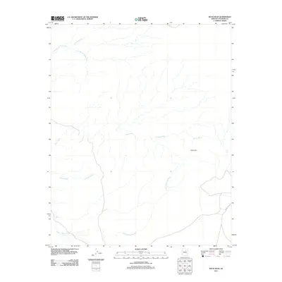
2011 Map of Rock Head
USGS Topo · Published 2011About this map
Rock Head rises as a prominent landmark in this desert landscape within Coconino County, defined by a complex network of seasonal drainages. The area's hydrology is dominated by significant ephemeral channels including the Tohachi Wash, Antelope Wash, and the notably named Haada Is Taani Di Wash. These dry watercourses trace the natural flow of the terrain, moving across a largely undeveloped region where modern infrastructure is minimal. Evidence of localized water management for livestock or wildlife is seen at Gadii Ahi Tank in the southwestern portion of the sheet. Transportation is limited to Indian Rte 6720, which provides the primary access through the southeastern corner. Further north, the landscape is etched by the Little Mexican Spring Wash and Gold Spring Wash, illustrating the characteristic drainage patterns of the high desert plateau.
Find a feature on this map
8 named features on this map. Tap any name to fly to it.
Don’t see what you’re looking for? This feature index may not catch every label — zoom into the map to look around manually.
Map Details
Editions of this 2011 Rock Head Map
This is the sole edition of this map. No revisions or reprints were ever made.
Other maps of this area

1883 · Tusayan
USGS Topo · 1:250,000

1886 · Tusayan
USGS Topo · 1:250,000

1886 · San Francisco Mtns
USGS Topo · 1:250,000

1891 · San Francisco Mtns
USGS Topo · 1:250,000

1894 · San Francisco Mtns
USGS Topo · 1:250,000

1899 · San Francisco Mtns
USGS Topo · 1:250,000

1947 · Flagstaff
USGS Topo · 1:250,000

1954 · Flagstaff
USGS Topo · 1:250,000

1955 · Black Falls 4 SW
USGS Topo · 1:24,000
1955 · Black Falls 4 SE
USGS Topo · 1:24,000