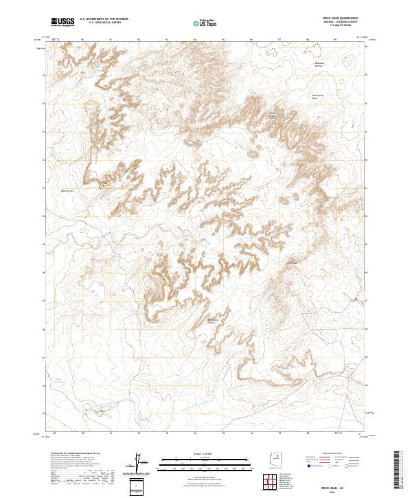
2021 Map of Rock Head
USGS Topo · Published 2021About this map
Moenkopi Plateau and Sand Springs Mesa dominate the northern landscape of this Coconino County terrain, where the high desert is defined by a series of dramatic vertical drops and drainages. The Adeii Eechii Cliffs and Red Rock Cliffs create sharp topographic boundaries that separate the upper plateaus from the lower expanses of Ward Terrace. This environment is characterized by an intricate network of seasonal watercourses, including Gold Spring Wash and Haada Is Taani Di Wash, which channel runoff through the arid basins.
Find a feature on this map
16 named features on this map. Tap any name to fly to it.
Don’t see what you’re looking for? This feature index may not catch every label — zoom into the map to look around manually.
Map Details
Editions of this 2021 Rock Head Map
This is the sole edition of this map. No revisions or reprints were ever made.
Other maps of this area

1883 · Tusayan
USGS Topo · 1:250,000

1886 · Tusayan
USGS Topo · 1:250,000

1886 · San Francisco Mtns
USGS Topo · 1:250,000

1891 · San Francisco Mtns
USGS Topo · 1:250,000

1894 · San Francisco Mtns
USGS Topo · 1:250,000

1899 · San Francisco Mtns
USGS Topo · 1:250,000

1947 · Flagstaff
USGS Topo · 1:250,000

1954 · Flagstaff
USGS Topo · 1:250,000

1955 · Black Falls 4 SW
USGS Topo · 1:24,000
1955 · Black Falls 4 SE
USGS Topo · 1:24,000