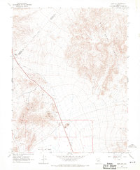
1968 Map of Rock Hill
USGS Topo · Published 1970About this map
The Rock Hill Mines and Broken Toe Mine define the industrial footprint of this high desert region in the late 1960s. Located at the intersection of the Candelaria Hills and the Monte Cristo Range, the area is marked by numerous Prospects and a Borrow Pit indicative of mineral exploration. An Old Railroad Grade cuts diagonally across the terrain, tracing a legacy of transport that once connected local mining interests to the broader Nevada network.
Find a feature on this map
17 named features on this map. Tap any name to fly to it.
Don’t see what you’re looking for? This feature index may not catch every label — zoom into the map to look around manually.
Map Details
Editions of this 1968 Rock Hill Map
2 editions found
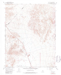
Other maps of this area

1907 · Tonopah
USGS Topo · 1:250,000

1908 · Tonopah
USGS Topo · 1:250,000

1909 · Hawthorne
USGS Topo · 1:250,000

1911 · Hawthorne
USGS Topo · 1:250,000

1915 · Hawthorne
USGS Topo · 1:250,000

1948 · Walker Lake
USGS Topo · 1:250,000

1956 · Tonopah
USGS Topo · 1:250,000

1957 · Walker Lake
USGS Topo · 1:250,000

1959 · Tonopah
USGS Topo · 1:250,000

1962 · Walker Lake
USGS Topo · 1:250,000