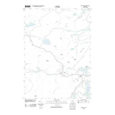
2010 Map of Rock Lake
USGS Topo · Published 2010About this map
Indian Lake sits at the heart of this central Adirondack landscape, where the waters of the Indian River and Cedar River converge near the northeastern reaches of the Adirondack Park. The settlement of Indian Lake is depicted alongside recreational landmarks such as the Cedar River Golf Course and the quiet waters of Adirondack Lake and Lake Abanakee. The map illustrates a complex network of waterways, including the Essex Chain Lakes and the remote Rock Lake, linked by numerous brooks such as Johnny Mack Brook and Nicholas Brook.
Find a feature on this map
40 named features on this map. Tap any name to fly to it.
Don’t see what you’re looking for? This feature index may not catch every label — zoom into the map to look around manually.
Map Details
Editions of this 2010 Rock Lake Map
This is the sole edition of this map. No revisions or reprints were ever made.
Other maps of this area

1898 · Newcomb
USGS Topo · 1:62,500

1898 · Thirteenth Lake
USGS Topo · 1:62,500

1899 · Indian Lake
USGS Topo · 1:62,500

1901 · Newcomb
USGS Topo · 1:62,500

1902 · Indian Lake
USGS Topo · 1:62,500

1903 · Blue Mountain
USGS Topo · 1:62,500

1950 · Utica
USGS Topo · 1:250,000

1954 · Newcomb
USGS Topo · 1:62,500

1954 · Thirteenth Lake
USGS Topo · 1:62,500

1954 · Blue Mountain
USGS Topo · 1:62,500