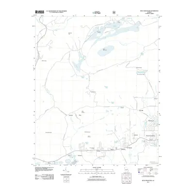
2011 Map of Rock Mountain
USGS Topo · Published 2011About this map
Turnip Mountain and Judy Mountain anchor this landscape northwest of Rome, where small residential clusters and farming operations define the local geography. Small settlements such as Fouche, Lavender, and Bone are linked by a network of rural roads like Big Texas Valley Rd NW and Huffaker Rd NW. The area is notably dense with small water bodies, including Selman Lakes, Peacock Lake, and Berry Reservoir, which are supported by the drainage of Heath Creek and Smith Creek.
Find a feature on this map
75 named features on this map. Tap any name to fly to it.
Don’t see what you’re looking for? This feature index may not catch every label — zoom into the map to look around manually.
Map Details
Editions of this 2011 Rock Mountain Map
This is the sole edition of this map. No revisions or reprints were ever made.
Other maps of this area

1886 · Rome
USGS Topo · 1:125,000

1898 · Rome
USGS Topo · 1:125,000

1899 · Rome
USGS Topo · 1:125,000

1904 · Rome
USGS Topo · 1:125,000

1955 · Rome
USGS Topo · 1:250,000

1958 · Rome
USGS Topo · 1:250,000

1961 · Rome
USGS Topo · 1:250,000

1963 · Rome
USGS Topo · 1:250,000
1966 · Lyerly
USGS Topo · 1:24,000
1967 · Summerville
USGS Topo · 1:24,000