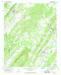
1966 Map of Lyerly
USGS Topo · Published 1969About this map
Lyerly serves as a focal point in this mid-1960s landscape, positioned where the Central of Georgia railroad parallels the winding path of the Chattooga River. This survey captures the transition from the rugged slopes of Dirtseller Mountain and Shinbone Ridge to the fertile agricultural stretches of Broomtown Valley. The map documents several small, established communities including Menlo, Berryton, and Alpine, each marked by their respective churches and family cemeteries.
Find a feature on this map
52 named features on this map. Tap any name to fly to it.
Don’t see what you’re looking for? This feature index may not catch every label — zoom into the map to look around manually.
Map Details
Editions of this 1966 Lyerly Map
2 editions found
Other maps of this area

1886 · Ringgold
USGS Topo · 1:125,000

1886 · Rome
USGS Topo · 1:125,000

1886 · Stevenson
USGS Topo · 1:125,000

1892 · Ringgold
USGS Topo · 1:125,000

1892 · Stevenson
USGS Topo · 1:125,000

1893 · Fort Payne
USGS Topo · 1:125,000

1895 · Stevenson
USGS Topo · 1:125,000

1898 · Rome
USGS Topo · 1:125,000

1898 · Fort Payne
USGS Topo · 1:125,000

1899 · Rome
USGS Topo · 1:125,000