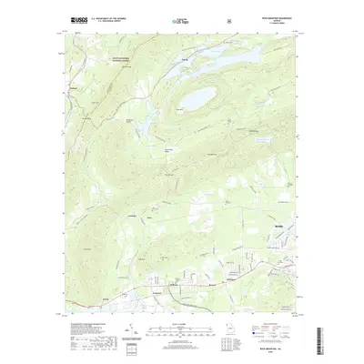
2020 Map of Rock Mountain
USGS Topo · Published 2020About this map
Simms Mountain and Lavender Mtn dominate the landscape northwest of Rome, creating a series of enclosed valleys where agricultural communities such as Big Texas Valley and Little Texas Valley have long persisted. The 2020 terrain shows a topography defined by steep ridges and tactical gaps like Kitchen Gap and Fouche Gap, which have historically funneled local transit between the rugged highlands and the drainage of Heath Creek. These valleys are dotted with ancestral markers, including the Antioch Cem and Sand Springs Cem, while the southern reaches near Coosa and Krannert show a more developed industrial and suburban footprint. The presence of Berry Reservoir and several small catchments like Glovers Lake and Peacock Lake reflects the region's managed water resources nestled within the northern Chattahoochee National Forest boundaries.
Find a feature on this map
114 named features on this map. Tap any name to fly to it.
Don’t see what you’re looking for? This feature index may not catch every label — zoom into the map to look around manually.
Map Details
Editions of this 2020 Rock Mountain Map
This is the sole edition of this map. No revisions or reprints were ever made.
Other maps of this area

1886 · Rome
USGS Topo · 1:125,000

1898 · Rome
USGS Topo · 1:125,000

1899 · Rome
USGS Topo · 1:125,000

1904 · Rome
USGS Topo · 1:125,000

1955 · Rome
USGS Topo · 1:250,000

1958 · Rome
USGS Topo · 1:250,000

1961 · Rome
USGS Topo · 1:250,000

1963 · Rome
USGS Topo · 1:250,000
1966 · Lyerly
USGS Topo · 1:24,000
1967 · Summerville
USGS Topo · 1:24,000