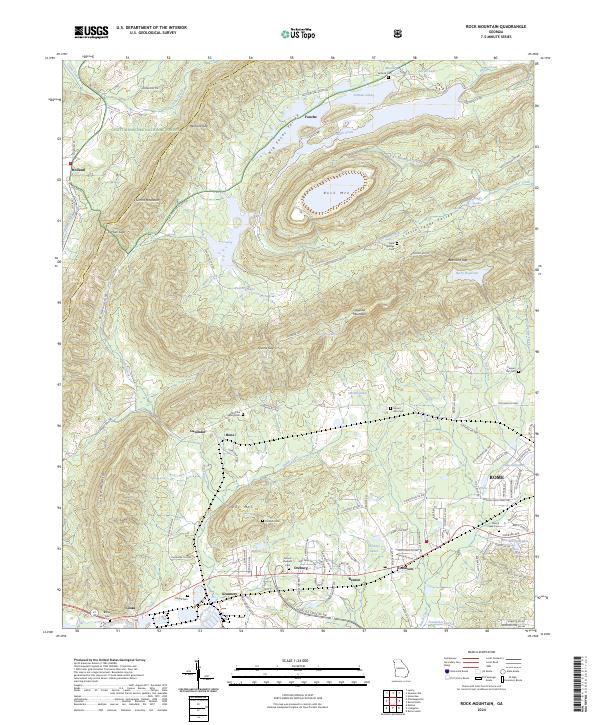
2024 Map of Rock Mountain
USGS Topo · Published 2024About this map
Simms Mountain and the ridgelines of the Chattahoochee National Forest dominate the northern landscape of this Floyd County study. The terrain is defined by several significant gaps, including Henricks Gap, Kitchen Gap, and Fouche Gap, which historically funneled travel through this complex valley system. Small settlements like Fouche, Lavender, and Bone are dispersed among the foothills, connected by routes such as Big Texas Valley Rd NW. To the south, the topography flattens as it approaches the developed fringes of Rome, where the landscape transitions from forestry and rural holdings to residential pockets near Rice Springs Lake. Genealogists will find a high density of small burial grounds throughout the area, including Antioch Cem, Sand Springs Cem, and the uniquely named Possum Trot Cem near Little Dry Creek. This network of cemeteries and named springs, such as Beard Spring and Rice Spring, reflects a long-standing pattern of family-centered rural settlement.
Find a feature on this map
111 named features on this map. Tap any name to fly to it.
Don’t see what you’re looking for? This feature index may not catch every label — zoom into the map to look around manually.
Map Details
Editions of this 2024 Rock Mountain Map
This is the sole edition of this map. No revisions or reprints were ever made.
Other maps of this area

1886 · Rome
USGS Topo · 1:125,000

1898 · Rome
USGS Topo · 1:125,000

1899 · Rome
USGS Topo · 1:125,000

1904 · Rome
USGS Topo · 1:125,000

1955 · Rome
USGS Topo · 1:250,000

1958 · Rome
USGS Topo · 1:250,000

1961 · Rome
USGS Topo · 1:250,000

1963 · Rome
USGS Topo · 1:250,000
1966 · Lyerly
USGS Topo · 1:24,000
1967 · Summerville
USGS Topo · 1:24,000