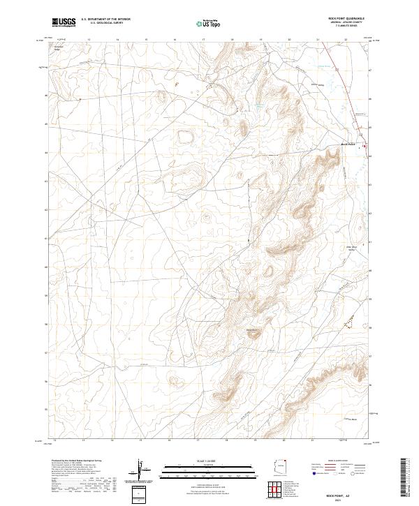
2021 Map of Rock Point
USGS Topo · Published 2021About this map
Rock Point serves as the primary hub for this arid landscape in the Navajo Nation, where the high desert floor meets the rising relief of Carson Mesa to the southeast. The geography is defined by the broad Chinle Valley, through which the meandering Chinle Wash flows toward the north. This drainage system provides a vital corridor for travel and settlement in a region marked by significant landforms such as Plane Rock and Antelope Ridge. The map details a network of indigenous and county routes, including Indian Rte 8014 and Indian Rte 35, which connect isolated water sources like Setsiltso Springs. The terrain transitions from the open stretches of Dibe Chaa Valley to the more complex topography of the mesa edge, illustrating the relationship between the area's natural hydrology and its contemporary road infrastructure.
Find a feature on this map
22 named features on this map. Tap any name to fly to it.
Don’t see what you’re looking for? This feature index may not catch every label — zoom into the map to look around manually.
Map Details
Editions of this 2021 Rock Point Map
This is the sole edition of this map. No revisions or reprints were ever made.
Other maps of this area

1892 · Canyon De Chelly
USGS Topo · 1:250,000

1952 · Dinnehotso
USGS Topo · 1:62,500

1952 · Setsiltso Springs 2 SE
USGS Topo · 1:24,000

1954 · Shiprock
USGS Topo · 1:250,000

1958 · Shiprock
USGS Topo · 1:250,000

1959 · Shiprock
USGS Topo · 1:250,000
1968 · Hogansaani Spring
USGS Topo · 1:24,000

1968 · Rock Point SW
USGS Topo · 1:24,000
1968 · Dancing Rocks
USGS Topo · 1:24,000
1968 · White Point
USGS Topo · 1:24,000