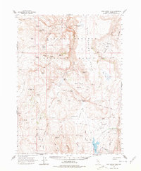
1965 Map of Rock Spring Table
USGS Topo · Published 1977About this map
Summit Lake Indian Reservation anchors this high-desert terrain, where the waters of Summit Lake sit framed by the Big Rock Mountain Range and Mahogany Mountain. The landscape is a network of survival and early settlement, marked by established cattle outposts like Wilson Ranch and Alkali Ranch. The map reveals the historical military footprint of the region, specifically at Camp McGarry (Ruins) and the sprawling Old Military Reservation Bdy, which speak to a nineteenth-century frontier presence. In this arid basin, water is the primary organizer of human activity, as evidenced by the numerous named water sources such as Chokecherry Spring, Tenmile Spring, and the Alkali Reservoir. The northern reaches are defined by the broad plateau of Rock Spring Table, while the south includes local landmarks like Bear Buttes and the Summit Lake Cem.
Find a feature on this map
59 named features on this map. Tap any name to fly to it.
Don’t see what you’re looking for? This feature index may not catch every label — zoom into the map to look around manually.
Map Details
Editions of this 1965 Rock Spring Table Map
2 editions found
Other maps of this area

1886 · Disaster
USGS Topo · 1:250,000

1889 · Long Valley
USGS Topo · 1:250,000

1893 · Disaster
USGS Topo · 1:250,000

1954 · Vya
USGS Topo · 1:250,000

1958 · Vya
USGS Topo · 1:250,000

1962 · Vya
USGS Topo · 1:250,000

1965 · Railroad Point
USGS Topo · 1:62,500

1965 · Idaho Canyon
USGS Topo · 1:62,500

1965 · Rock Spring Table
USGS Topo · 1:62,500

1966 · Big Spring Butte
USGS Topo · 1:62,500