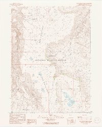
1990 Map of Rock Spring Table
USGS Topo · Published 1990About this map
Sheldon National Wildlife Refuge encompasses the high desert plateau of this Humboldt County quadrangle, a landscape defined by volcanic mesas and critical water sources. The extensive volcanic plateau of Rock Spring Table dominates the center of the sheet, dropping away into the broad Rock Spring Basin. This area reflects the essential nature of the Great Basin water systems, where isolated sources like Rock Spring, East Rock Spring, and Cottonwood Spring provided the only reliable moisture for ranching and wildlife in an arid environment. Human activity is sparse, marked primarily by the Alkali Ranch and the Rock Spring Table Reservoir. Further south, the terrain transitions into the Wild Horse Pasture near Onion Lake, illustrating the traditional land use patterns of the Nevada high country in the late 20th century.
Find a feature on this map
14 named features on this map. Tap any name to fly to it.
Don’t see what you’re looking for? This feature index may not catch every label — zoom into the map to look around manually.
Map Details
Editions of this 1990 Rock Spring Table Map
2 editions found
Other maps of this area

1886 · Disaster
USGS Topo · 1:250,000

1889 · Long Valley
USGS Topo · 1:250,000

1893 · Disaster
USGS Topo · 1:250,000

1954 · Vya
USGS Topo · 1:250,000

1958 · Vya
USGS Topo · 1:250,000

1962 · Vya
USGS Topo · 1:250,000

1965 · Railroad Point
USGS Topo · 1:62,500

1965 · Idaho Canyon
USGS Topo · 1:62,500

1965 · Rock Spring Table
USGS Topo · 1:62,500

1966 · Big Spring Butte
USGS Topo · 1:62,500