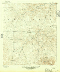
1893 Map of Rock Springs
USGS Topo · Published 1949About this map
The Edwards Plateau ranching landscape of the 1890s is defined here by a network of isolated homesteads and essential water sources across Sutton, Kimble, and Edwards counties. Settlers established operations near seasonal and permanent waters, including Eight Mile Water Hole, Ten Mile Water Hole, and McKenzie Lake, reflecting the critical importance of hydrology in this semi-arid environment. The town of Rock Springs serves as the primary hub in the south, while the northern reaches are dominated by family-named holdings like Stegalls Ranch and Wentworth Ranch.
Find a feature on this map
35 named features on this map. Tap any name to fly to it.
Don’t see what you’re looking for? This feature index may not catch every label — zoom into the map to look around manually.
Map Details
Editions of this 1893 Rock Springs Map
5 editions found
Other maps of this area

1893 · Rock Springs
USGS Topo · 1:125,000

1893 · Fort McKavett
USGS Topo · 1:125,000

1893 · Nueces
USGS Topo · 1:125,000

1896 · Nueces
USGS Topo · 1:125,000

1926 · Segovia 2-c
USGS Topo · 1:48,000

1932 · Junction
USGS Topo · 1:62,500

1943 · Carta Valley
USGS Topo · 1:62,500

1944 · Indian Creek
USGS Topo · 1:62,500

1947 · Hackberry
USGS Topo · 1:62,500

1954 · Llano
USGS Topo · 1:250,000