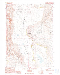
1990 Map of Rock Springs Table
USGS Topo · Published 1990About this map
Sheldon National Wildlife Refuge dominates this high-desert landscape in northern Humboldt County, where the distinctive flat-topped Rock Spring Table rises between the Rock Spring Basin and Big Mountain. The mapping reveals a remote environment defined by scattered water sources vital for both wildlife and early ranching, including Rock Spring, Alkali Spring, and Cottonwood Spring.
Find a feature on this map
14 named features on this map. Tap any name to fly to it.
Don’t see what you’re looking for? This feature index may not catch every label — zoom into the map to look around manually.
Map Details
Editions of this 1990 Rock Springs Table Map
2 editions found
Other maps of this area

1886 · Disaster
USGS Topo · 1:250,000

1889 · Long Valley
USGS Topo · 1:250,000

1893 · Disaster
USGS Topo · 1:250,000

1954 · Vya
USGS Topo · 1:250,000

1958 · Vya
USGS Topo · 1:250,000

1962 · Vya
USGS Topo · 1:250,000

1965 · Railroad Point
USGS Topo · 1:62,500

1965 · Idaho Canyon
USGS Topo · 1:62,500

1965 · Rock Spring Table
USGS Topo · 1:62,500

1966 · Big Spring Butte
USGS Topo · 1:62,500