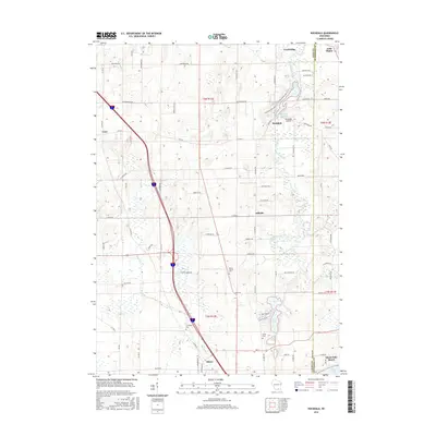
2016 Map of Rockdale
USGS Topo · Published 2016About this map
Koshkonong Creek winds southward through this portion of Dane and Jefferson Counties, serving as the primary hydrological spine for the village of Rockdale and the surrounding agricultural landscape. The presence of the Rockdale Millpond and several glacial water bodies, including Rice Lake, Sweet Lake, and Turtle Lake, suggests a terrain shaped by post-glacial drainage patterns common to this part of Wisconsin. Settlement clusters are concentrated at Cambridge in the north and Albion in the south, the latter being an important site for family researchers with the location of Evergreen Cem and the Albion Prairie Cem.
Find a feature on this map
80 named features on this map. Tap any name to fly to it.
Don’t see what you’re looking for? This feature index may not catch every label — zoom into the map to look around manually.
Map Details
Editions of this 2016 Rockdale Map
This is the sole edition of this map. No revisions or reprints were ever made.
Other maps of this area

1890 · Sun Prairie
USGS Topo · 1:62,500

1890 · Stoughton
USGS Topo · 1:62,500

1891 · Waterloo
USGS Topo · 1:62,500

1891 · Koshkonong
USGS Topo · 1:62,500

1894 · Waterloo
USGS Topo · 1:62,500

1894 · Koshkonong
USGS Topo · 1:62,500

1896 · Sun Prairie
USGS Topo · 1:62,500

1905 · Sun Prairie
USGS Topo · 1:62,500

1906 · Koshkonong
USGS Topo · 1:62,500

1907 · Sun Prairie
USGS Topo · 1:62,500