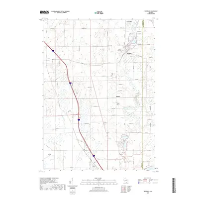
2018 Map of Rockdale
USGS Topo · Published 2018About this map
Koshkonong Creek winds through this rural landscape on the border of Dane and Jefferson Counties, anchoring a region defined by its deep Scandinavian heritage and scattered agricultural hamlets. The map documents several significant early burial sites, including the Pioneer Norwegian Cem and the Rockdale Lutheran Church Cem, which reflect the 19th-century settlement patterns of the area. The village of Rockdale sits at a geographic crossroads near Cam-Rock Park Area 3, while the southern reaches of the map transitions toward Albion and the marshy edges of Rice Lake. This 2018 survey illustrates the persistence of small-scale aviation at the Rockdale Airport and the intricate network of farm-to-market roads like Tobacco Rd and Koshkonong Rd that have long supported the local economy.
Find a feature on this map
73 named features on this map. Tap any name to fly to it.
Don’t see what you’re looking for? This feature index may not catch every label — zoom into the map to look around manually.
Map Details
Editions of this 2018 Rockdale Map
This is the sole edition of this map. No revisions or reprints were ever made.
Other maps of this area

1890 · Sun Prairie
USGS Topo · 1:62,500

1890 · Stoughton
USGS Topo · 1:62,500

1891 · Waterloo
USGS Topo · 1:62,500

1891 · Koshkonong
USGS Topo · 1:62,500

1894 · Waterloo
USGS Topo · 1:62,500

1894 · Koshkonong
USGS Topo · 1:62,500

1896 · Sun Prairie
USGS Topo · 1:62,500

1905 · Sun Prairie
USGS Topo · 1:62,500

1906 · Koshkonong
USGS Topo · 1:62,500

1907 · Sun Prairie
USGS Topo · 1:62,500