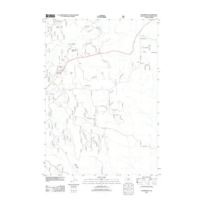
2012 Map of Rockerville
USGS Topo · Published 2012About this map
Rockerville sits at the heart of this Pennington County landscape, surrounded by a complex network of gulches and ridges that define the Black Hills topography. The settlement is anchored by local landmarks such as the Rockerville Cem and the Rockerville Airport, while the nearby Stratosphere Bowl and Strato Rim Overlook Campground indicate the area's importance for both scientific history and recreation. The drainage patterns are clearly defined by Spring Cr and Deadman Cr to the north, and Battle Cr in the south, which have carved out features like Victoria Gulch and Foster Gulch. This 2012 survey illustrates the modern road network, including Sheridan Lake RD and Sitting Bull Rd, which weave through the varied terrain of Gold Hill and Turkey Ridge, connecting isolated springs like Jackson Spring to the larger community.
Find a feature on this map
68 named features on this map. Tap any name to fly to it.
Don’t see what you’re looking for? This feature index may not catch every label — zoom into the map to look around manually.
Map Details
Editions of this 2012 Rockerville Map
This is the sole edition of this map. No revisions or reprints were ever made.
Other maps of this area

1893 · Rapid
USGS Topo · 1:125,000

1894 · Hermosa
USGS Topo · 1:125,000

1898 · Rapid
USGS Topo · 1:125,000

1901 · Hermosa
USGS Topo · 1:125,000

1903 · Rapid
USGS Topo · 1:125,000

1953 · Hermosa NW
USGS Topo · 1:24,000

1953 · Rapid City East
USGS Topo · 1:24,000

1953 · Hermosa
USGS Topo · 1:24,000

1953 · Rapid City West
USGS Topo · 1:24,000

1953 · Rapid City
USGS Topo · 1:250,000