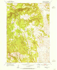
1954 Map of Rockerville
USGS Topo · Published 1955About this map
Rockerville sits at the heart of this mid-century survey, a settlement deeply integrated into the landscape of the Black Hills National Forest. The map documents a period when local infrastructure was defined by rural educational centers like Reder Sch, Blair Sch, and Pine Grove Sch, alongside a persistent mining economy. Resource extraction is evident in the south, where the Rattlesnake Mine, Giltedge Mine, and a Mica Mine are situated near the banks of Battle Creek. The topography is marked by significant drainages and geological features, including the distinct Stratosphere Bowl, Crystal Cave, and the winding Deadman Gulch. For those researching local heritage, the Rockerville Cem provides a specific point of reference for the families who settled this rugged area of Pennington County.
Find a feature on this map
22 named features on this map. Tap any name to fly to it.
Don’t see what you’re looking for? This feature index may not catch every label — zoom into the map to look around manually.
Map Details
Editions of this 1954 Rockerville Map
3 editions found
Other maps of this area

1893 · Rapid
USGS Topo · 1:125,000

1894 · Hermosa
USGS Topo · 1:125,000

1898 · Rapid
USGS Topo · 1:125,000

1901 · Hermosa
USGS Topo · 1:125,000

1903 · Rapid
USGS Topo · 1:125,000

1953 · Hermosa NW
USGS Topo · 1:24,000

1953 · Rapid City East
USGS Topo · 1:24,000

1953 · Hermosa
USGS Topo · 1:24,000

1953 · Rapid City West
USGS Topo · 1:24,000

1953 · Rapid City
USGS Topo · 1:250,000