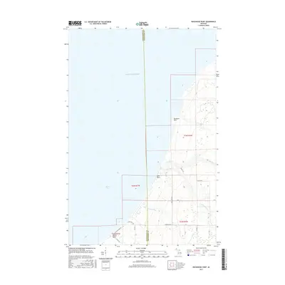
2017 Map of Rockhouse Point
USGS Topo · Published 2017About this map
Rockhouse Point defines this stretch of the Copper Country shoreline where the waters of Lake Superior meet the wooded interior of the Keweenaw Peninsula. The map reveals a remote coastal landscape shaped by the drainage systems of the Elm River and the S Br Elm River, which flow westward toward the lake. Small residential pockets and seasonal getaways are scattered along the coast, most notably at Santa Monica Beach and near Agate Beach.
Find a feature on this map
22 named features on this map. Tap any name to fly to it.
Don’t see what you’re looking for? This feature index may not catch every label — zoom into the map to look around manually.
Map Details
Editions of this 2017 Rockhouse Point Map
This is the sole edition of this map. No revisions or reprints were ever made.
Other maps of this area

1950 · Greenland
USGS Topo · 1:62,500

1951 · Greenland
USGS Topo · 1:62,500

1954 · Graveraet River
USGS Topo · 1:24,000

1954 · Beacon Hill
USGS Topo · 1:24,000

1954 · Rockhouse Point
USGS Topo · 1:24,000

1954 · Winona
USGS Topo · 1:62,500

1958 · Hancock
USGS Topo · 1:250,000

1958 · Iron River
USGS Topo · 1:250,000

1960 · Iron River
USGS Topo · 1:250,000

1960 · Hancock
USGS Topo · 1:250,000