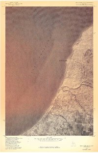
1978 Map of Rockhouse Point
USGS Topo · Published 1978About this map
Rockhouse Point defines this coastal stretch of Michigan’s Upper Peninsula, where the land meets the cold expanse of Lake Superior. This 1978 orthophotoquad represents a specialized mapping approach, layering traditional land survey lines over a high-altitude aerial photograph taken on October 28th of that year. The resulting imagery reveals the texture of the forest and the rhythmic curve of the shoreline in Houghton County, showing the intersection of Township and Range boundaries with the natural terrain. While the interior is sparsely labeled, the map provides a clear look at the undeveloped lakefront and the drainage patterns moving toward the water, providing a baseline for the region's environmental and forest history in the late 1970s.
Find a feature on this map
4 named features on this map. Tap any name to fly to it.
Don’t see what you’re looking for? This feature index may not catch every label — zoom into the map to look around manually.
Map Details
Editions of this 1978 Rockhouse Point Map
This is the sole edition of this map. No revisions or reprints were ever made.
Other maps of this area

1950 · Greenland
USGS Topo · 1:62,500

1951 · Greenland
USGS Topo · 1:62,500

1954 · Graveraet River
USGS Topo · 1:24,000

1954 · Beacon Hill
USGS Topo · 1:24,000

1954 · Rockhouse Point
USGS Topo · 1:24,000

1954 · Winona
USGS Topo · 1:62,500

1958 · Hancock
USGS Topo · 1:250,000

1958 · Iron River
USGS Topo · 1:250,000

1960 · Iron River
USGS Topo · 1:250,000

1960 · Hancock
USGS Topo · 1:250,000