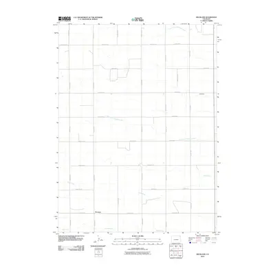
2010 Map of Rockland
USGS Topo · Published 2010About this map
Rockland sits at the intersection of a vast, orthogonal road network in this high plains region of Logan County. The landscape is defined by the ephemeral drainage patterns of the North Fork Frenchman Creek and South Fork Frenchman Creek, which carve gentle paths across the agricultural grid. These waterways, along with Sandy Creek and Patent Creek to the south, represent the vital hydraulic lifelines for the scattered farmsteads connected by routes like County Rd 91 and County Rd 12. The presence of the Koch Dam in the northeast corner of the quadrangle highlights the critical role of water management in sustaining local ranching and farming operations. This 2010 survey illustrates the enduring rural character of northeastern Colorado, where the precise section lines of the Public Land Survey System remain the primary framework for human settlement and transport.
Find a feature on this map
22 named features on this map. Tap any name to fly to it.
Don’t see what you’re looking for? This feature index may not catch every label — zoom into the map to look around manually.
Map Details
Editions of this 2010 Rockland Map
This is the sole edition of this map. No revisions or reprints were ever made.
Other maps of this area

1954 · Sterling
USGS Topo · 1:250,000

1958 · Sterling
USGS Topo · 1:250,000

1962 · Fleming
USGS Topo · 1:24,000

1962 · Haxtun East
USGS Topo · 1:24,000

1962 · Haxtun West
USGS Topo · 1:24,000

1971 · Clarkville NE
USGS Topo · 1:24,000

1971 · Haxtun SE
USGS Topo · 1:24,000

1972 · Clarkville
USGS Topo · 1:24,000

1972 · New Haven
USGS Topo · 1:24,000

1972 · St Petersburg
USGS Topo · 1:24,000