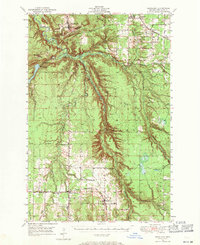
1949 Map of Rockland
USGS Topo · Published 1971About this map
Rockland sits at the northern end of this mid-century Ontonagon County landscape, marking a transition between the elevated terrain of South Bluff and the intricate river systems below. The copper-rich history of the region is quietly evidenced by a Shaft and the Woodlawn Cem near the town site. Further south, the map documents the rural development around Bruce Crossing and Paynesville, where the Duluth South Shore And Atlantic railroad and the Chicago Milwaukee ST Paul And Pacific line provided essential transit for the timber and mining industries.
Find a feature on this map
39 named features on this map. Tap any name to fly to it.
Don’t see what you’re looking for? This feature index may not catch every label — zoom into the map to look around manually.
Map Details
Editions of this 1949 Rockland Map
2 editions found
Other maps of this area

1949 · Rockland
USGS Topo · 1:62,500

1950 · Greenland
USGS Topo · 1:62,500

1951 · Rockland
USGS Topo · 1:62,500

1951 · Greenland
USGS Topo · 1:62,500

1952 · Watersmeet
USGS Topo · 1:62,500

1952 · Thayer
USGS Topo · 1:62,500

1954 · Rousseau
USGS Topo · 1:62,500

1954 · Kenton
USGS Topo · 1:62,500

1954 · Winona
USGS Topo · 1:62,500

1955 · Ontonagon
USGS Topo · 1:62,500