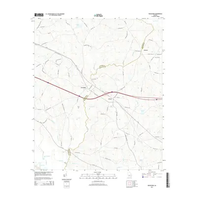
2014 Map of Rockledge
USGS Topo · Published 2014About this map
Rockledge and Orland serve as the primary focal points of this rural landscape where Laurens and Treutlen counties meet. The terrain is defined by a dense network of blackwater creeks and swampy lowlands, most notably where the Oconee River creates a complex of seasonal waterways including Muddy Slough, Cross Slough, and Jack Lake. The map reveals a deeply established agricultural and timber-linked road system, often named for local families, such as Thigpen Cemetery Rd and Lloyd Hester Rd. Historically significant crossings like Mercer Ford on Hurricane Creek highlight how travelers navigated this water-rich environment before modern bridging. The presence of Mt Zion Cemetery near the center of the quadrangle offers a specific point of interest for those researching local lineage and the early community centers of this Georgia backcountry.
Find a feature on this map
82 named features on this map. Tap any name to fly to it.
Don’t see what you’re looking for? This feature index may not catch every label — zoom into the map to look around manually.
Map Details
Editions of this 2014 Rockledge Map
This is the sole edition of this map. No revisions or reprints were ever made.
Other maps of this area

1957 · Macon
USGS Topo · 1:250,000

1958 · Macon
USGS Topo · 1:250,000

1964 · Macon
USGS Topo · 1:250,000

1971 · Soperton South
USGS Topo · 1:24,000

1971 · Soperton North
USGS Topo · 1:24,000

1971 · Lothair
USGS Topo · 1:24,000

1971 · Rockledge
USGS Topo · 1:24,000

1974 · Lowery
USGS Topo · 1:24,000

1974 · East Dublin
USGS Topo · 1:24,000

1974 · Scott
USGS Topo · 1:24,000