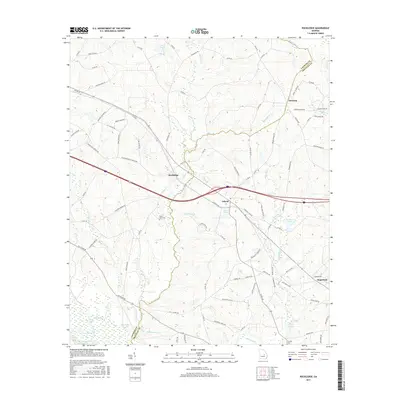
2017 Map of Rockledge
USGS Topo · Published 2017About this map
The Oconee River corridor and its associated wetlands, including Muddy Slough and Jack Lake, define the southwestern edge of this landscape at the border of Laurens and Treutlen counties. Settlement centers on the rural communities of Rockledge and Orland, connected by a network of local routes such as Old River Rd and Rockledge Blue Springs Rd. The map illustrates a transition from the river bottomlands to the agricultural uplands where Soperton begins to appear in the southeast. Numerous family-named landmarks and water bodies, such as Miller Pond and Peterson Pond, suggest long-standing land tracts in this portion of Georgia. Genealogists may find value in the locations of rural burying grounds like Mount Zion Cem and Fowlers Cem, situated among the various branches of Red Bluff Cr and Hurricane Br.
Find a feature on this map
96 named features on this map. Tap any name to fly to it.
Don’t see what you’re looking for? This feature index may not catch every label — zoom into the map to look around manually.
Map Details
Editions of this 2017 Rockledge Map
This is the sole edition of this map. No revisions or reprints were ever made.
Other maps of this area

1957 · Macon
USGS Topo · 1:250,000

1958 · Macon
USGS Topo · 1:250,000

1964 · Macon
USGS Topo · 1:250,000

1971 · Soperton South
USGS Topo · 1:24,000

1971 · Soperton North
USGS Topo · 1:24,000

1971 · Lothair
USGS Topo · 1:24,000

1971 · Rockledge
USGS Topo · 1:24,000

1974 · Lowery
USGS Topo · 1:24,000

1974 · East Dublin
USGS Topo · 1:24,000

1974 · Scott
USGS Topo · 1:24,000