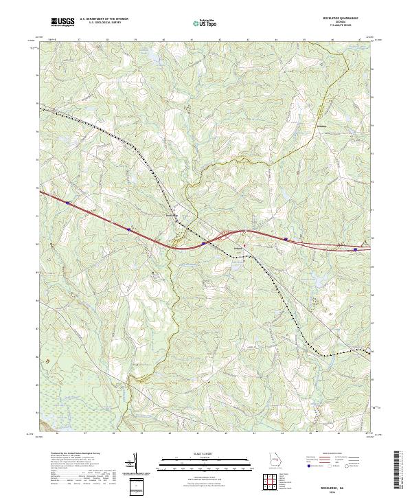
2024 Map of Rockledge
USGS Topo · Published 2024About this map
Rockledge serves as the central hub of this East Georgia landscape, situated where the Laurens Co Treutlen Co boundary winds through the watershed of Mercer Creek. The terrain is defined by a complex network of wetlands and drainages that feed into the Oconee River at the southwestern corner of the sheet. Notable water features like Graham Ponds, Lake Helen, and the slow-moving Muddy Slough indicate a low-lying environment typical of the coastal plain, while small clusters like Orland and Orianna anchor the local road network.
Find a feature on this map
93 named features on this map. Tap any name to fly to it.
Don’t see what you’re looking for? This feature index may not catch every label — zoom into the map to look around manually.
Map Details
Editions of this 2024 Rockledge Map
This is the sole edition of this map. No revisions or reprints were ever made.
Other maps of this area

1957 · Macon
USGS Topo · 1:250,000

1958 · Macon
USGS Topo · 1:250,000

1964 · Macon
USGS Topo · 1:250,000

1971 · Soperton South
USGS Topo · 1:24,000

1971 · Soperton North
USGS Topo · 1:24,000

1971 · Lothair
USGS Topo · 1:24,000

1971 · Rockledge
USGS Topo · 1:24,000

1974 · Lowery
USGS Topo · 1:24,000

1974 · East Dublin
USGS Topo · 1:24,000

1974 · Scott
USGS Topo · 1:24,000