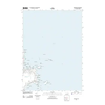
2012 Map of Rockport
USGS Topo · Published 2012About this map
Cape Ann's jagged coastline is the centerpiece of this study, revealing a landscape defined by its intimate relationship with the Atlantic Ocean. The settlement of Rockport is anchored by Bearskin Neck and the T Wharf, serving as a focal point for maritime activity. Moving north and south along the rocky shore, smaller communities like Ocean View, Pigeon Cove, and Lands End illustrate the historic coastal development pattern of Essex County.
Find a feature on this map
72 named features on this map. Tap any name to fly to it.
Don’t see what you’re looking for? This feature index may not catch every label — zoom into the map to look around manually.
Map Details
Editions of this 2012 Rockport Map
This is the sole edition of this map. No revisions or reprints were ever made.
Other maps of this area

1886 · Gloucester
USGS Topo · 1:62,500

1888 · Gloucester
USGS Topo · 1:62,500

1893 · Gloucester
USGS Topo · 1:62,500

1918 · Gloucester
USGS Topo · 1:62,500

1943 · Cape Ann
USGS Topo · 1:125,000
1945 · Rockport
USGS Topo · 1:31,680
1947 · Rockport
USGS Topo · 1:25,000

1948 · Boston
USGS Topo · 1:250,000
1949 · Rockport
USGS Topo · 1:24,000

1956 · Boston
USGS Topo · 1:250,000