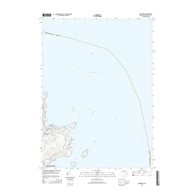
2015 Map of Rockport
USGS Topo · Published 2015About this map
Cape Ann defines the easternmost point of this coastal landscape, where the town of Rockport meets the sea at Bearskin Neck. The terrain is characterized by a dense network of local roads such as Marmion Way and Straits Mouth Way that follow the jagged shoreline, reflecting the established residential and maritime character of the area. Interior water features like Saumill Brook and Gum Rock Lake drain toward the coast, while the southern boundary transitions into the city of Gloucester near Long Bch. Beyond the immediate rocky coast lies the Atlantic Ocean and Bigelow Bight, marking the maritime edge of Essex County. This survey illustrates the intricate street plan of the village core, including Broadway and High St, providing a clear record of the community's modern footprint along the northern Massachusetts coast.
Find a feature on this map
28 named features on this map. Tap any name to fly to it.
Don’t see what you’re looking for? This feature index may not catch every label — zoom into the map to look around manually.
Map Details
Editions of this 2015 Rockport Map
This is the sole edition of this map. No revisions or reprints were ever made.
Other maps of this area

1886 · Gloucester
USGS Topo · 1:62,500

1888 · Gloucester
USGS Topo · 1:62,500

1893 · Gloucester
USGS Topo · 1:62,500

1918 · Gloucester
USGS Topo · 1:62,500

1943 · Cape Ann
USGS Topo · 1:125,000
1945 · Rockport
USGS Topo · 1:31,680
1947 · Rockport
USGS Topo · 1:25,000

1948 · Boston
USGS Topo · 1:250,000
1949 · Rockport
USGS Topo · 1:24,000

1956 · Boston
USGS Topo · 1:250,000