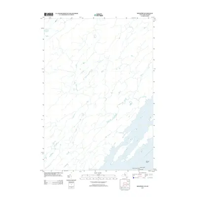
2013 Map of Rockport
USGS Topo · Published 2013About this map
Whiskey Island and Arcadia Island punctuate the aquatic landscape of the Thousand Islands along the international border in this early twenty-first-century survey. The map details the intricate shoreline of the Lake of the Isles, a sheltered water body protected by the surrounding landmasses. On the mainland, the course of Beaver Meadow Cr drains the low-lying interior toward the river. This specific edition is notable for its focus on hydrography and boundary lines during a period of modern geospatial standard updates, though it lacks the traditional contour lines found on earlier topographic sheets. Smaller features like Sylvan Island and Little Lehigh Island reflect the densely clustered island geography that has long defined the region's character.
Find a feature on this map
6 named features on this map. Tap any name to fly to it.
Don’t see what you’re looking for? This feature index may not catch every label — zoom into the map to look around manually.
Map Details
Editions of this 2013 Rockport Map
This is the sole edition of this map. No revisions or reprints were ever made.
Other maps of this area

1903 · Grindstone
USGS Topo · 1:62,500

1903 · Alexandria Bay
USGS Topo · 1:62,500

1943 · Thousand Island Park
USGS Topo · 1:31,680

1943 · Redwood
USGS Topo · 1:31,680

1943 · Alexandria Bay
USGS Topo · 1:31,680

1948 · Chippewa Bay
USGS Topo · 1:24,000

1948 · Alexandria Bay
USGS Topo · 1:62,500

1948 · Ogdensburg
USGS Topo · 1:250,000

1951 · Ogdensburg
USGS Topo · 1:250,000

1953 · Ogdensburg
USGS Topo · 1:250,000