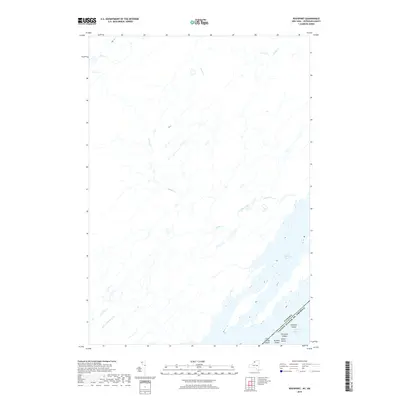
2019 Map of Rockport
USGS Topo · Published 2019About this map
The Saint Lawrence River serves as the dominant geographical and political boundary on this map, marking the international border between the Canada and the United States. Within the river's channel, a cluster of the Thousand Islands are charted, including Whiskey Island, Arcadia Island, Sylvan Island, and Little Lehigh Island. These landforms, situated in the southeastern portion of the sheet, represent a distinctive archipelago landscape where water and land intricately overlap. Inland, the hydrology is defined by multiple drainage systems, including Jones Cr, Beaver Meadow Cr, and the winding course of LaRue Creek. The lack of named roads or town centers on this specific 2019 data set emphasizes the natural riparian environment and the complexity of the river's many channels and small island chains.
Find a feature on this map
11 named features on this map. Tap any name to fly to it.
Don’t see what you’re looking for? This feature index may not catch every label — zoom into the map to look around manually.
Map Details
Editions of this 2019 Rockport Map
This is the sole edition of this map. No revisions or reprints were ever made.
Other maps of this area

1903 · Grindstone
USGS Topo · 1:62,500

1903 · Alexandria Bay
USGS Topo · 1:62,500

1943 · Thousand Island Park
USGS Topo · 1:31,680

1943 · Redwood
USGS Topo · 1:31,680

1943 · Alexandria Bay
USGS Topo · 1:31,680

1948 · Chippewa Bay
USGS Topo · 1:24,000

1948 · Alexandria Bay
USGS Topo · 1:62,500

1948 · Ogdensburg
USGS Topo · 1:250,000

1951 · Ogdensburg
USGS Topo · 1:250,000

1953 · Ogdensburg
USGS Topo · 1:250,000