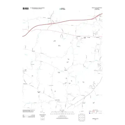
2013 Map of Rockvale
USGS Topo · Published 2013About this map
Rockvale and the surrounding Rutherford County countryside are defined by a complex karst landscape and small-scale aviation hubs. Natural landmarks such as Snail Shell Cave Spring and Overall Springs underscore the region's unique hydrography, while a high density of private landing strips, including Mc Donald Airport, Triune Airfield, Ellis Field Airport, and Gibson Airport, reveals a distinct post-war pattern of local transport and recreation.
Find a feature on this map
110 named features on this map. Tap any name to fly to it.
Don’t see what you’re looking for? This feature index may not catch every label — zoom into the map to look around manually.
Map Details
Editions of this 2013 Rockvale Map
This is the sole edition of this map. No revisions or reprints were ever made.
Other maps of this area

1916 · Murfreesboro
USGS Topo · 1:62,500

1936 · Chapel Hill
USGS Topo · 1:24,000

1936 · Rover
USGS Topo · 1:24,000

1936 · Fosterville
USGS Topo · 1:24,000

1942 · Lebanon
USGS Topo · 1:100,000

1944 · Shelbyville
USGS Topo · 1:100,000
1949 · Rover
USGS Topo · 1:24,000
1949 · Chapel Hill
USGS Topo · 1:24,000
1949 · Fosterville
USGS Topo · 1:24,000

1950 · Walterhill
USGS Topo · 1:24,000