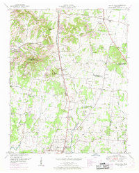
1949 Map of Chapel Hill
USGS Topo · Published 1966About this map
Chapel Hill and Eagleville anchor this mid-century survey of Middle Tennessee, showing a rural landscape defined by the Tennessee Valley Divide. The map details a dense network of family-named cemeteries and community crossroads that reveal the social geography of the era. The Louisville and Nashville railroad runs north-south through the center, connecting settlements like Holtland (PO) and Winn Crossing.
Find a feature on this map
71 named features on this map. Tap any name to fly to it.
Don’t see what you’re looking for? This feature index may not catch every label — zoom into the map to look around manually.
Map Details
Editions of this 1949 Chapel Hill Map
2 editions found
Other maps of this area

1909 · Franklin
USGS Topo · 1:62,500

1936 · Chapel Hill
USGS Topo · 1:24,000

1936 · Farmington
USGS Topo · 1:24,000

1936 · Rover
USGS Topo · 1:24,000

1936 · Verona
USGS Topo · 1:24,000

1936 · Rally Hill
USGS Topo · 1:24,000

1936 · Unionville
USGS Topo · 1:24,000

1936 · Bethesda
USGS Topo · 1:24,000

1942 · Lebanon
USGS Topo · 1:100,000

1944 · Shelbyville
USGS Topo · 1:100,000